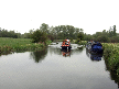
| Rushy Mead |
 |

Click to enlarge - Cliquer pour agrandir |
Lower Sheering seen by Google Earth.
|
| Lower Sheering vu par Google Earth. |
04-05-2008

Click to enlarge - Cliquer pour agrandir |
Looking to the South, the Stort Navigation to the South of Matchstick Footbridge No.47.
|
| Les regards portés vers le Sud, la Rivière Canalisée Stort au Sud de la Passerelle n°47 de Matchstick. |
04-05-2008

Click to enlarge - Cliquer pour agrandir |
Looking to the North, the Stort Navigation to the South of Matchstick Footbridge No.47.
|
| Les regards portés vers le Nord, la Rivière Canalisée Stort au Sud de la Passerelle n°47 de Matchstick. |
04-05-2008

Click to enlarge - Cliquer pour agrandir |
Matchstick Footbridge No.47 seen from the South.
|
| La Passerelle n°47 de Matchstick vue du Sud. |

Click to enlarge - Cliquer pour agrandir |
Matchstick Footbridge No.47 seen by Google Earth.
|
| La Passerelle n°47 de Matchstick vue par Google Earth. |
04-05-2008

Click to enlarge - Cliquer pour agrandir |
Looking to the South, the Stort Navigation seen from Matchstick Footbridge No.47.
|
| Les regards portés vers le Sud, la Rivière Canalisée Stort vu de la Passerelle n°47 de Matchstick. |
04-05-2008

Click to enlarge - Cliquer pour agrandir |
Looking to the North, the Stort Navigation seen from Matchstick Footbridge No.47.
|
| Les regards portés vers le Nord, la Rivière Canalisée Stort vu de la Passerelle n°47 de Matchstick. |
04-05-2008

Click to enlarge - Cliquer pour agrandir |
Pig Lane Bridge No.48 seen from the West.
|
| Le Pont n°48 de la Pig Lane vu de l'Ouest. |
04-05-2008

Click to enlarge - Cliquer pour agrandir |
Looking to the West, the Stort Navigation seen from Pig Lane Bridge No.48.
|
| Les regards portés vers l'Ouest, la Rivière Canalisée Stort vu du Pont n°48 de la Pig Lane. |
04-05-2008

Click to enlarge - Cliquer pour agrandir |
Twyford Lock No.2 seen from Pig Lane Bridge No.48.
|
| L'Ecluse n°2 de Twyford vue du Pont n°48 de la Pig Lane. |
04-05-2008

Click to enlarge - Cliquer pour agrandir |
Twyford Lock No.2 seen from the East.
|
| L'Ecluse n°2 de Twyford vue de l'Est. |

Click to enlarge - Cliquer pour agrandir |
Twyford Lock No.2 seen by Google Earth.
|
| L'Ecluse n°2 de Twyford vue par Google Earth. |
04-05-2008

Click to enlarge - Cliquer pour agrandir |
Looking to the East, the Stort Navigation seen from Twyford Lock No.2.
|
| Les regards portés vers l'Est, la Rivière Canalisée Stort vu de l'Ecluse n°2 de Twyford. |
04-05-2008

Click to enlarge - Cliquer pour agrandir |
Looking to the West, the Stort Navigation to the East of Twyford Lock No.2.
|
| Les regards portés vers l'Ouest, la Rivière Canalisée Stort à l'Est de l'Ecluse n°2 de Twyford. |
04-05-2008

Click to enlarge - Cliquer pour agrandir |
Looking to the East, the Stort Navigation to the East of Twyford Lock No.2.
|
| Les regards portés vers l'Est, la Rivière Canalisée Stort à l'Est de l'Ecluse n°2 de Twyford. |
04-05-2008

Click to enlarge - Cliquer pour agrandir |
Looking to the South, the Stort Navigation to the South of South Mill Lock No.1.
|
| Les regards portés vers le Sud, la Rivière Canalisée Stort au Sud de l'Ecluse n°1 de la South Mill. |
04-05-2008

Click to enlarge - Cliquer pour agrandir |
South Mill Arm.
|
| La Branche de la South Mill. |
04-05-2008

Click to enlarge - Cliquer pour agrandir |
Mooring to the South of South Mill Lock No.1.
|
| Amarrage au Sud de l'Ecluse n°1 de la South Mill. |

Click to enlarge - Cliquer pour agrandir |
South Mill Arm seen by Google Earth.
|
| La Branche de la South Mill vue par Google Earth. |
04-05-2008

Click to enlarge - Cliquer pour agrandir |
South Mill Lock No.1 seen from the South.
|
| L'Ecluse n°1 de la South Mill vue du Sud. |

Click to enlarge - Cliquer pour agrandir |
South Mill Lock No.1 seen by Google Earth.
|
| L'Ecluse n°1 de la South Mill vue par Google Earth. |
04-05-2008

Click to enlarge - Cliquer pour agrandir |
Looking to the South, the Stort Navigation seen from South Mill Lock No.1.
|
| Les regards portés vers le Sud, la Rivière Canalisée Stort vu de l'Ecluse n°1 de la South Mill. |
04-05-2008

Click to enlarge - Cliquer pour agrandir |
Looking to the North, the Stort Navigation seen from South Mill Lock No.1.
|
| Les regards portés vers le Nord, la Rivière Canalisée Stort vu de l'Ecluse n°1 de la South Mill. |
04-05-2008

Click to enlarge - Cliquer pour agrandir |
Looking to the South, the Stort Navigation to the South of Railway Bridge No.49B.
|
| Les regards portés vers le Sud, la Rivière Canalisée Stort au Sud du Pont Ferroviaire n°49B. |

Click to enlarge - Cliquer pour agrandir |
Railway Bridge No.49B seen by Google Earth.
|
| Le Pont Ferroviaire n°49B vu par Google Earth. |
|
Visitez/Bezoek/Visit
Click on the image - cliquer sur l'image |
|
Stort Navigation. |
|
|