|
Bristol |
 |
|
Bristol |
|
|
| In the early days, Bristol was a tidal harbour on the banks of the River Avon. Later, locks were built at the entrance of the harbour with a result that the harbour was tide free. To allow, the water of the River Avon to flow to the sea, a diversion canal had to be built: the "New Cut". | A l'origine, le port de Bristol était un port de marée le long de la rivière Avon. Par après, des écluses furent construites à l'entrée du port évitant ainsi à la marée de remonter dans le port. Afin de permettre aux aux de la rivière Avon de s'écouler vers la mer, un canal de dérivation fut construit: la "Nouvelle Coupure". |
Click to enlarge - Cliquer pour agrandir |
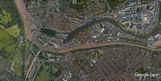
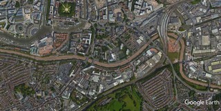
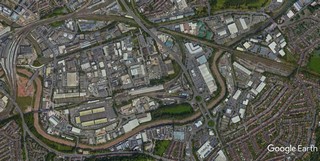
The Cut seen by Google Earth.
|
| La Coupure vue par Google Earth. |
20-07-2015
Click to enlarge - Cliquer sur l'image pour agrandir |
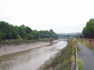
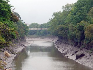
Looking to the South, the Cut to the North of Cumberland Basin Lock No.2.
|
| Les regards portés vers le Sud, la Coupure au Nord de l'Écluse n°2 du Bassin de Cumberland. |
10-09-2005
Click to enlarge - Cliquer pour agrandir |
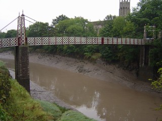
The New Cut and the Vauxhall Footbridge seen from Cumberand Road.
|
| La Nouvelle Coupure et la Passerelle Vauxhall vues de la Cumberland Road. |
Click to enlarge - Cliquer pour agrandir |
The Cut seen by Google Earth.
|
| La Coupure vue par Google Earth. |
10-09-2005
Click to enlarge - Cliquer pour agrandir |
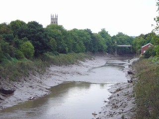
Gaolferry Footbridge seen from the West. To the right, Southville Church.
|
| La Passerelle de Gaolferry vue de l'Ouest. À droite, l'Église de Southville. |
10-09-2005
Click to enlarge - Cliquer pour agrandir |
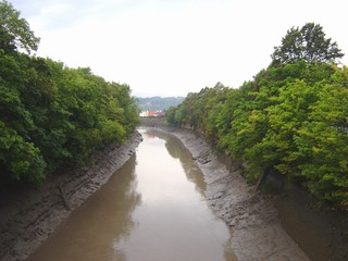
Looking to the West, the New Cut seen from Gaolferry Footbridge.
|
| Les regards portés vers l'Ouest, la Nouvelle Coupure vue de la Passerelle de Gaolferry. |
11-09-2005
Click to enlarge - Cliquer pour agrandir |
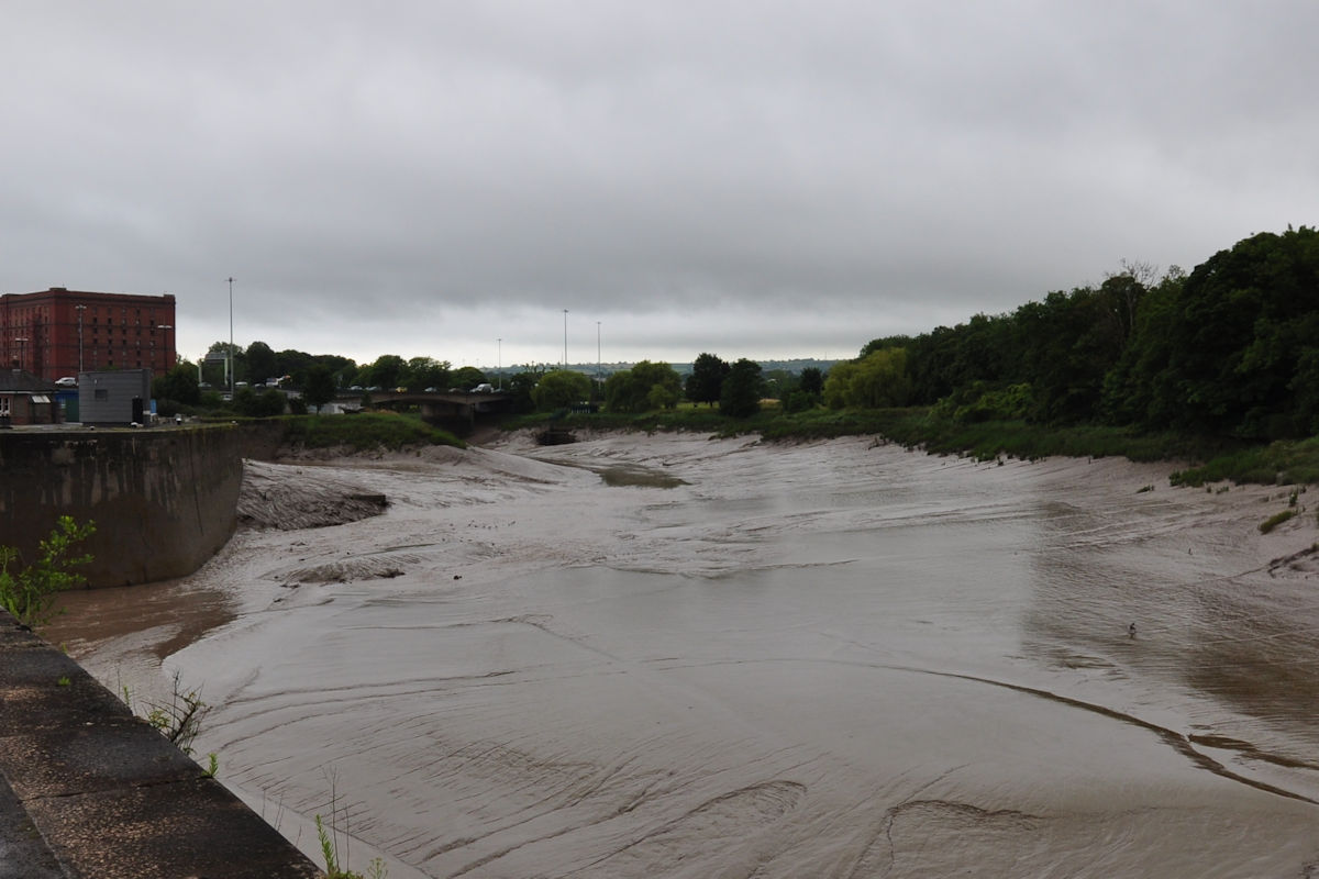
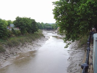
The New Cut seen from Commercial Road close to Redcliffe Hill.
La Nouvelle Coupure vue de la Commercial Road à proximité de Redcliffe Hill.
|
10-09-2005
Click to enlarge - Cliquer pour agrandir |
The New Cut seen from Corenation Road.
La Nouvelle Coupure vue de la Corenation Road. |
11-09-2005
Click to enlarge - Cliquer pour agrandir |
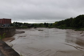
The New Cut seen from Commercial Road close to Bathurst Basin.
At the back, to the left, Southville Church; to the right, Gaolferry Footbridge.
La Nouvelle Coupure vue de la à proximité de Bathurst Basin. A l'arrière, à gauche, l'église de Southville; à droite, la Passerelle de Gaolferry. |
Click to enlarge - Cliquer pour agrandir |
The Cut seen by Google Earth.
|
| La Coupure vue par Google Earth. |
|
Visitez/Bezoek/Visit
Click on the image - cliquer sur l'image |
|
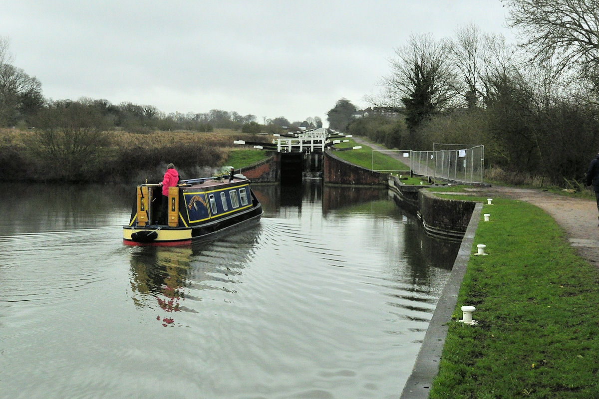
The Kennet & Avon Canal |
|
|