| Moorland |
 |
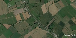
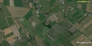
Click to enlarge - Cliquer pour agrandir |
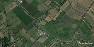
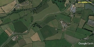
The River Parrett seen by Google Earth.
|
| La Parrett vue par Google Earth. |
17-06-2015
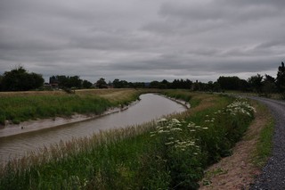
Click to enlarge - Cliquer sur l'image pour agrandir |
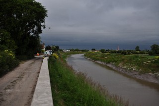
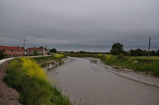
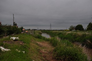
Looking to the North-West, the River Parrett downtream of Burrow Bridge. Picture taken from OS Grid ST 3527 3088.
|
| Les regards portés vers le Nord-ouest, la Parrett en aval du Pont de Burrow. Prise de vue depuis la coordonée OS ST 3527 3088. |
17-06-2015
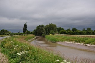
Click to enlarge - Cliquer sur l'image pour agrandir |
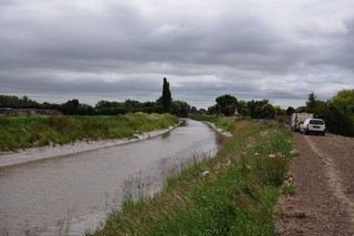
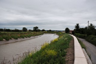
Looking to the South-East, the River Parrett downtream of Burrow Bridge. Picture taken from OS Grid ST 3513 9048.
|
| Les regards portés vers le Sud-est, la Parrett en aval du Pont de Burrow. Prise de vue depuis la coordonée OS ST 3513 9048. |
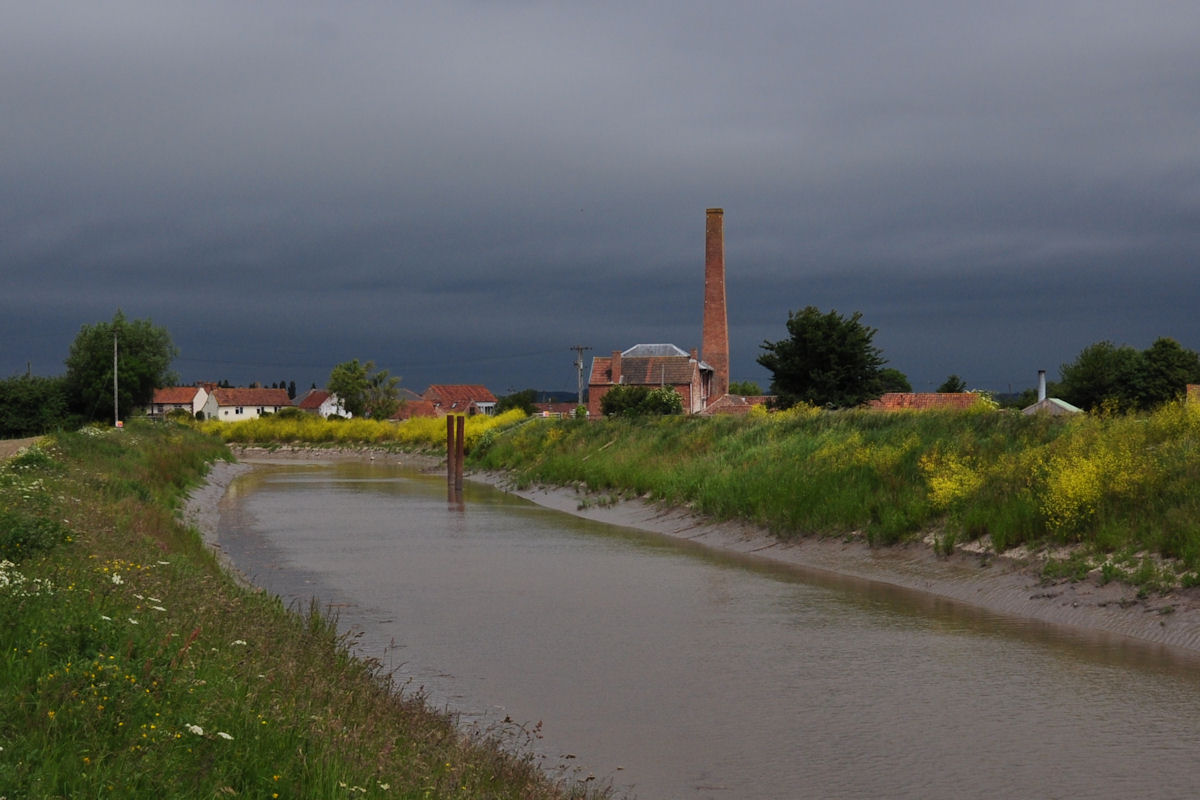
Click to enlarge - Cliquer pour agrandir |
The River Parrett seen by Google Earth.
|
| La Parrett vue par Google Earth. |
17-06-2015
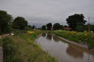
Click to enlarge - Cliquer sur l'image pour agrandir |
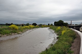
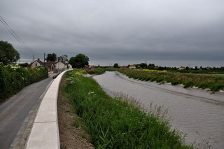
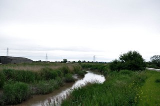
Looking to the East, the River Parrett downstream of Burrow Bridge. Picture taken from OS Grid ST 3432 3205.
|
| Les regards portés vers l'Est, la Parrett en aval du Pont de Burrow. Prise de vue depuis la coordonée OS ST 3432 3205. |
17-06-2015
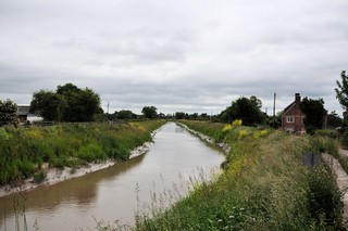
Click to enlarge - Cliquer sur l'image pour agrandir |
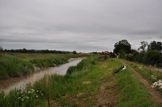
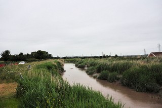
Looking to the North, the River Parrett downstream of Burrow Bridge. Picture taken from OS Grid ST 3432 3205.
|
| Les regards portés vers le Nord, la Parrett en aval du Pont de Burrow. Prise de vue depuis la coordonée OS ST 3432 3205. |
17-06-2015
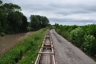
Click to enlarge - Cliquer sur l'image pour agrandir |
Downstream of Burrow Bridge. Picture taken from OS Grid ST 3418 3230.
|
| En aval du Pont de Burrow. Prise de vue depuis la coordonée OS ST 3418 3230. |
17-06-2015
Click to enlarge - Cliquer sur l'image pour agrandir |
Looking to the North-West, the River Parrett downstream of Burrow Bridge. Picture taken from OS Grid ST 3418 3230.
|
| Les regards portés vers le Nord-ouest, la Parrett en aval du Pont de Burrow. Prise de vue depuis la coordonée OS ST 3418 3230. |
17-06-2015
Click to enlarge - Cliquer sur l'image pour agrandir |
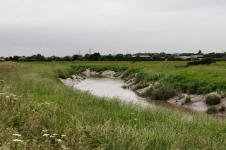
Looking to the South, the River Parrett downstream of Burrow Bridge. Picture taken from OS Grid ST 3404 3247.
|
| Les regards portés vers le Sud, la Parrett en aval du Pont de Burrow. Prise de vue depuis la coordonée OS ST 3404 3247. |
17-06-2015

Click to enlarge - Cliquer sur l'image pour agrandir |
Looking to the North, the River Parrett downstream of Burrow Bridge. Picture taken from OS Grid ST 3404 3247.
|
| Les regards portés vers le Nord, la Parrett en aval du Pont de Burrow. Prise de vue depuis la coordonée OS ST 3404 3247. |
Click to enlarge - Cliquer pour agrandir |
The River Parrett seen by Google Earth.
|
| La Parrett vue par Google Earth. |
17-06-2015
Click to enlarge - Cliquer sur l'image pour agrandir |
Looking to the East, the River Parrett downstream of Burrow Bridge.
|
| Les regards portés vers l'Est, la Parrett en aval du Pont de Burrow. |
17-06-2015
Click to enlarge - Cliquer sur l'image pour agrandir |
Looking to the North-West, the River Parrett downstream of Burrow Bridge.
|
| Les regards portés vers le Nord-ouest, la Parrett en aval du Pont de Burrow. |
17-06-2015
Click to enlarge - Cliquer sur l'image pour agrandir |
Looking to the South-East, the River Parrett upstream of Dunwear Motorway Bridge. Picture taken from OS Grid ST 3334 3294.
|
| Les regards portés vers le Sud-est, la Parrett en amont du Pont Autoroutier de Dunwear. Prise de vue depuis la coordonée OS ST 3334 3294. |
17-06-2015
Click to enlarge - Cliquer sur l'image pour agrandir |
Looking to the North-West, the River Parrett upstream of Dunwear Motorway Bridge. Picture taken from OS Grid ST 3334 3294.
|
| Les regards portés vers le Nord-ouest, la Parrett en amont du Pont Autoroutier de Dunwear. Prise de vue depuis la coordonée OS ST 3334 3294. |
17-06-2015
Click to enlarge - Cliquer sur l'image pour agrandir |
Looking to the South-East, the River Parrett upstream of Dunwear Motorway Bridge. Picture taken from OS Grid ST 3334 3294.
|
| Les regards portés vers le Sud-est, la Parrett en amont du Pont Autoroutier de Dunwear. Prise de vue depuis la coordonée OS ST 3334 3294. |
17-06-2015
Click to enlarge - Cliquer sur l'image pour agrandir |
Looking to the North-West, the River Parrett upstream of Dunwear Motorway Bridge. Picture taken from OS Grid ST 3334 3294.
|
| Les regards portés vers le Nord-ouest, la Parrett en amont du Pont Autoroutier de Dunwear. Prise de vue depuis la coordonée OS ST 3334 3294. |
Click to enlarge - Cliquer pour agrandir |
The River Parrett seen by Google Earth.
|
| La Parrett vue par Google Earth. |
17-06-2015
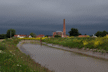
Click to enlarge - Cliquer sur l'image pour agrandir |
Looking to the South-East, the River Parrett upstream of Dunwear Motorway Bridge.
|
| Les regards portés vers le Sud-est, la Parrett en amont du Pont Autoroutier de Dunwear. |
17-06-2015

Click to enlarge - Cliquer sur l'image pour agrandir |
Looking to the North-West, the River Parrett upstream of Dunwear Motorway Bridge. Picture taken from OS Grid ST 3243 3385.
|
| Les regards portés vers le Nord-ouest, la Parrett en amont du Pont Autoroutier de Dunwear. Prise de vue depuis la coordonée OS ST 3243 3385. |
17-06-2015
Click to enlarge - Cliquer sur l'image pour agrandir |
Looking to the North, the River Parrett upstream of Dunwear Motorway Bridge. Picture taken from OS Grid ST 3244 3390.
|
| Les regards portés vers le Nord, la Parrett en amont du Pont Autoroutier de Dunwear. Prise de vue depuis la coordonée OS ST 3244 3390. |
17-06-2015
Click to enlarge - Cliquer sur l'image pour agrandir |
Looking to the North, the River Parrett upstream of Dunwear Motorway Bridge. Picture taken from OS Grid ST 3214 3440.
|
| Les regards portés vers le Nord, la Parrett en amont du Pont Autoroutier de Dunwear. Prise de vue depuis la coordonée OS ST 3214 3440. |
|
Visitez/Bezoek/Visit
Click on the image - cliquer sur l'image |
|
The River Parrett |
|
|