|
Roydon
Between Brick Lock and Mill Road Bridge |
 |
03-05-2008
Click to enlarge - Cliquer pour agrandir |
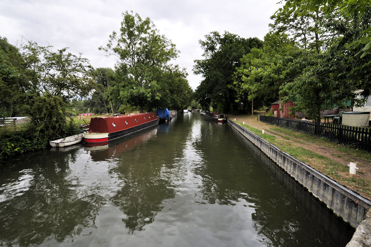
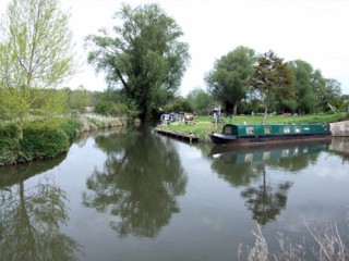
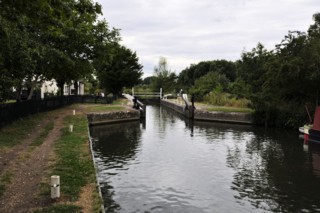
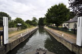
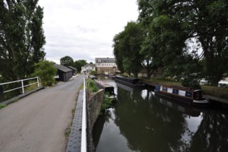
Looking to the South, the Stort Navigation to the South of Brick Lock No.14.
|
| Les regards portés vers le Sud, la Rivière Canalisée Stort au sud de l'Ecluse n°14 de Brick. |
03-05-2008
Click to enlarge - Cliquer pour agrandir |
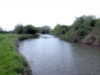
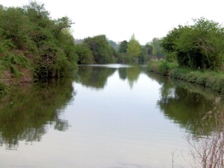
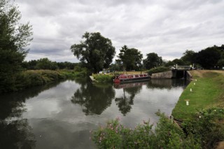
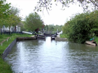
Looking to the Nord, the Stort Navigation to the South of Brick Lock No.14.
|
| Les regards portés vers le Nord, la Rivière Canalisée Stort au Sud de l'Ecluse Inférieure n°14 de Brick. |
03-05-2008
Click to enlarge - Cliquer pour agrandir |
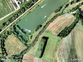
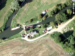
Stort Navigation to the South-west of Brick Lock No.14 seen by Google Earth.
|
| La Rivière Canalisée Stort au Sud-ouest de l'Ecluse n°14 de Brick vue par Google Earth. |
03-05-2008
Click to enlarge - Cliquer pour agrandir |
29-07-2010
Click to enlarge - Cliquer pour agrandir |
|
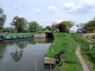
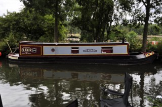
Mooring to the South-west of Brick Lock No.14. |
Amarrage au Sud-ouest de l'Ecluse n°14 de Brick. |
03-05-2008
Click to enlarge - Cliquer pour agrandir |
29-07-2010
Click to enlarge - Cliquer pour agrandir |
|
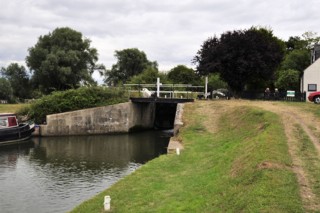
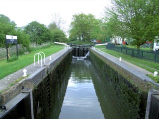
Brick Lock No.14 seen from the South-west. |
L'Ecluse n°14 de Brick vue du Sud-ouest. |
03-05-2008
Click to enlarge - Cliquer pour agrandir |
29-07-2010
Click to enlarge - Cliquer pour agrandir |
|
Brick Lock No.14 seen from the North-east. |
L'Ecluse n°14 de Brick vue du Nord-est. |
Click to enlarge - Cliquer pour agrandir |
Brick Lock No.14 seen by Google Earth.
|
| L'Ecluse n°14 de Brick vue par Google Earth. |
03-05-2008
Click to enlarge - Cliquer pour agrandir |
29-07-2010
Click to enlarge - Cliquer pour agrandir |
|
Brick Lock No.14. |
Ecluse Inférieure n°14 de Brick |
03-05-2008
Click to enlarge - Cliquer pour agrandir |
29-07-2010
Click to enlarge - Cliquer pour agrandir |
|
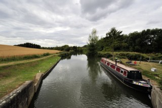
Looking to the South-west, the Stort Navigation seen from Brick Lock No.14. |
Les regards portés vers le Sud-ouest, la Rivière Canalisée Stort vu de l'Ecluse n°14 de Brick. |
29-07-2010
Click to enlarge - Cliquer pour agrandir |
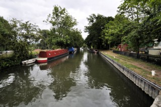
Looking to the North-east, the Stort Navigation seen from Brick Lock No.14.
|
| Les regards portés vers le Nord-est, la Rivière Canalisée Stort vu de l'Ecluse n°14 de Brick. |
29-07-2010
Click to enlarge - Cliquer pour agrandir |
29-07-2010
Click to enlarge - Cliquer pour agrandir |
|
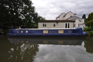
Mooring to the North of Brick Lock No.14. |
Amarrage au Nord de l'Ecluse n°14 de Brick. |
Click to enlarge - Cliquer pour agrandir |
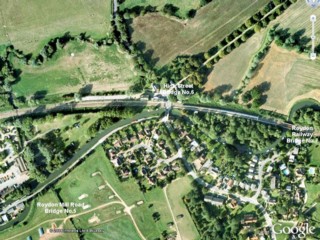
Roydon seen by Google Earth.
|
| Roydon vu par Google Earth. |
29-07-2010
Click to enlarge - Cliquer pour agrandir |
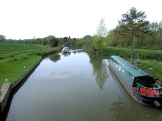
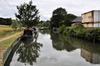
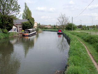
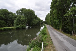
Looking to the West, the Stort Navigation to the West of Mill Road Bridge No.5.
|
| Les regards portés vers l'Ouest, la Rivière Canalisée Stort à l'Ouest du Pont n°5 de la Mill Road. |
03-05-2008
Click to enlarge - Cliquer pour agrandir |
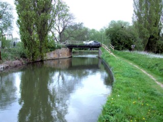
Looking to the East, the Stort Navigation to the South of Mill Road Bridge No.5.
|
| Les regards portés vers l'Est, la Rivière Canalisée Stort au Sud du Pont n°5 de la Mill Road. |
03-05-2008
Click to enlarge - Cliquer pour agrandir |
29-07-2010
Click to enlarge - Cliquer pour agrandir |
|
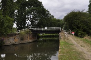
Mill Road Bridge No.5 No.5 seen from the South. |
Le Pont n°5 de la Mill Road vu du Sud. |
Click to enlarge - Cliquer pour agrandir |
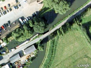
Mill Road Bridge No.5 No.5 seen by Google Earth.
|
| Le Pont n°5 de la Mill Road vu par Google Earth. |
29-07-2010
Click to enlarge - Cliquer pour agrandir |
Looking to the South-west, the Stort Navigation to the North-east of Mill Road Bridge No.5.
|
| Les regards portés vers le Sud-ouest, la Rivière Canalisée Stort au North-est du Pont n°5 de la Mill Road. |
29-07-2010
Click to enlarge - Cliquer pour agrandir |
Looking to the North-east, the Stort Navigation to the North-east of Mill Road Bridge No.5.
|
| Les regards portés vers le Nord-est, la Rivière Canalisée Stort au Nord-est du Pont n°5 de la Mill Road. |
|
Visitez/Bezoek/Visit
Click on the image - cliquer sur l'image |
|
Stort Navigation. |
|
|