|
Coxhill |
 |
Click to enlarge - Cliquer pour agrandir |
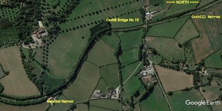
The Bridgwater & Taunton Canal seen by Google Earth.
|
| Le Canal de Bridgwater & Taunton vu par Google Earth. |
14-06-2015
Click to enlarge - Cliquer sur l'image pour agrandir |
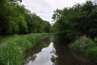
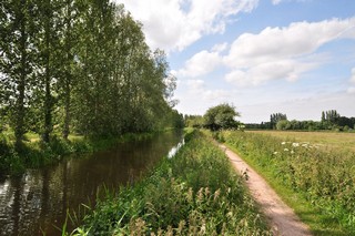
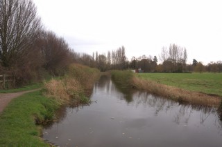
Maunsel Narrow seen from the South.
|
| Le Retrécissement de Maunsel vu du Sud. |
14-06-2015
Click to enlarge - Cliquer sur l'image pour agrandir |
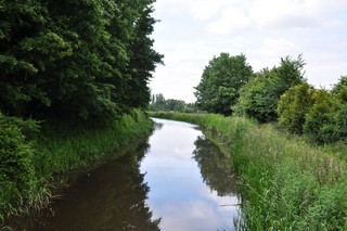
Maunsel Narrow seen from the North.
|
| Le Retrécissement de Maunsel vu du Nord. |
Click to enlarge - Cliquer sur l'image pour agrandir |
Maunsel Narrow seen by Google Earth.
|
| Le Retrécissement de Maunsel vu par Google Earth. |
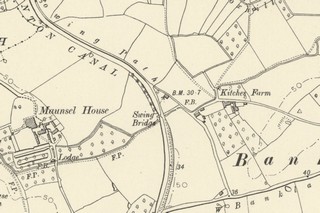
Credit: Sabre Click to enlarge - Cliquer sur l'image pour agrandir |
Old Ordnance Survey Map showing the site of Maunsel Narrow.
|
| Ancienne carte topographique du Retrécissement de Maunsel. |
14-06-2015
Click to enlarge - Cliquer sur l'image pour agrandir |
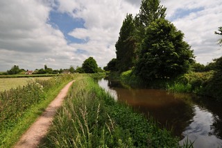
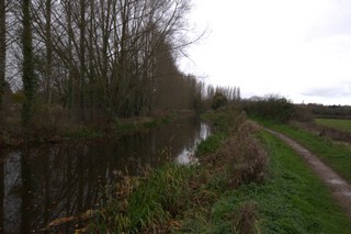
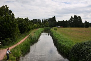
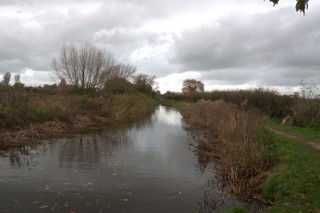
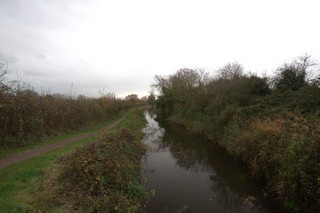
Looking to the South, the Bridgwater & Taunton Canal seen from Maunsel Narrow.
|
| Les regards portés vers le Sud, le Canal de Bridgwater & Taunton vu du Retrécissement de Maunsel. |
14-06-2015
Click to enlarge - Cliquer sur l'image pour agrandir |
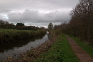
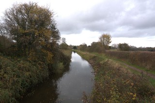
Looking to the North, the Bridgwater & Taunton Canal seen from Maunsel Narrow.
|
| Les regards portés vers le Nord, le Canal de Bridgwater & Taunton vu du Retrécissement de Maunsel. |
14-06-2015
Click to enlarge - Cliquer sur l'image pour agrandir |
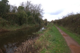
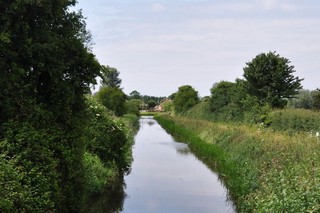
Looking to the South, the Bridgwater & Taunton Canal to the North of Maunsel Narrow.
|
| Les regards portés vers le Sud, le Canal de Bridgwater & Taunton au Nord du Retrécissement de Maunsel. |
14-06-2015
Click to enlarge - Cliquer sur l'image pour agrandir |
27-11-2017
Click to enlarge - Cliquer sur l'image pour agrandir |
|
Looking to the North-West, the Bridgwater & Taunton Canal to the North of Maunsel Narrow. |
Les regards portés vers le Nord-ouest, le Canal de Bridgwater & Taunton au Nord du Retrécissement de Maunsel. |
27-11-2017
Click to enlarge - Cliquer sur l'image pour agrandir |
Looking to the North, the Bridgwater & Taunton Canal to the South of Coxhill Bridge No.16.
|
| Les regards portés vers le Nord, le Canal de Bridgwater & Taunton au Sud du Pont n°16 de Coxhill. |
14-06-2015
Click to enlarge - Cliquer sur l'image pour agrandir |
27-11-2017
Click to enlarge - Cliquer sur l'image pour agrandir |
|
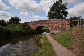
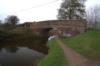
Coxhill Bridge No.16 seen from the South. |
Le Pont n°16 de Coxhill vu du Sud. |
14-06-2015
Click to enlarge - Cliquer sur l'image pour agrandir |
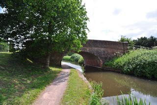
27-11-2017

Click to enlarge - Cliquer sur l'image pour agrandir |
|
Coxhill Bridge No.16 seen from the North. |
Le Pont n°16 de Coxhill vu du Nord. |
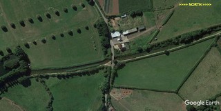
Click to enlarge - Cliquer sur l'image pour agrandir |
Coxhill Bridge No.16 seen by Google Earth.
|
| Le Pont n°16 de Coxhill vu par Google Earth. |
Credit: Sabre Click to enlarge - Cliquer sur l'image pour agrandir |
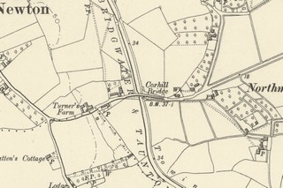
Old Ordnance Survey Map showing Coxhill Bridge No.16.
|
| Ancienne carte topographique du Pont n°16 de Coxhill. |
14-06-2015
Click to enlarge - Cliquer sur l'image pour agrandir |
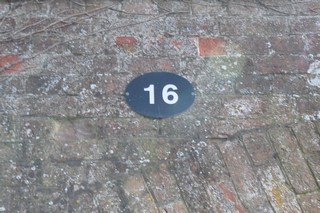
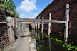
Identification plaque.
|
| Plaque d'Identification. |
14-06-2015
Click to enlarge - Cliquer sur l'image pour agrandir |
27-11-2017
Click to enlarge - Cliquer sur l'image pour agrandir |
|
Looking to the South, the Bridgwater & Taunton Canal seen from Coxhill Bridge No.16. |
Les regards portés vers le Sud, le Canal de Bridgwater & Taunton vu du Pont n°16 de Coxhill. |
|
14-06-2015
Click to enlarge - Cliquer sur l'image pour agrandir |
27-11-2017
Click to enlarge - Cliquer sur l'image pour agrandir |
|
Looking to the North, the Bridgwater & Taunton Canal seen from Coxhill Bridge No.16. |
Les regards portés vers le Nord, le Canal de Bridgwater & Taunton vu du Pont n°16 de Coxhill. |
27-11-2017
Click to enlarge - Cliquer sur l'image pour agrandir |
Looking to the South, the Bridgwater & Taunton Canal seen from below Coxhill Bridge No.16.
|
| Les regards portés vers le Sud, le Canal de Bridgwater & Taunton vu de sous du Pont n°16 de Coxhill. |
27-11-2017
Click to enlarge - Cliquer sur l'image pour agrandir |
Looking to the North, the Bridgwater & Taunton Canal seen from below Coxhill Bridge No.16.
|
| Les regards portés vers le Nord, le Canal de Bridgwater & Taunton vu de par-dessous du Pont n°16 de Coxhill. |
27-11-2017
Click to enlarge - Cliquer sur l'image pour agrandir |
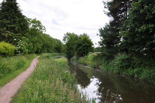
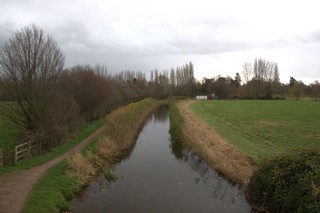
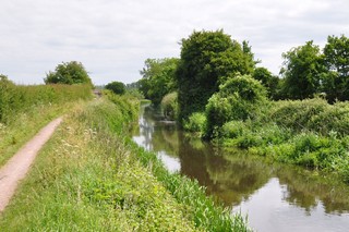
Looking to the North, the Bridgwater & Taunton Canal to the South of Coxhill Narrow.
|
| Les regards portés vers le Nord, le Canal de Bridgwater & Taunton au Sud du Retrécissement de Coxhill. |
27-11-2017

Click to enlarge - Cliquer sur l'image pour agrandir |
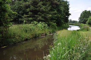
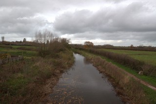
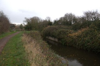
Coxhill Narrow seen from the South.
|
| Le Retrécissement de Coxhill vu du Sud. |
14-06-2015
Click to enlarge - Cliquer sur l'image pour agrandir |
27-11-2017
Click to enlarge - Cliquer sur l'image pour agrandir |
|
Coxhill Narrow seen from the North. |
Le Retrécissement de Coxhill vu du Nord. |
Click to enlarge - Cliquer sur l'image pour agrandir |
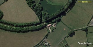
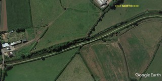
Coxhill Narrow seen by Google Earth.
|
| Le Retrécissement de Coxhill vu par Google Earth. |
Credit: Sabre Click to enlarge - Cliquer sur l'image pour agrandir |
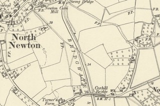
Old Ordnance Survey Map showing the site of Coxhill Narrow.
|
| Ancienne carte topographique du Retrécissement de Coxhill. |
14-06-2015
Click to enlarge - Cliquer sur l'image pour agrandir |
27-11-2017
Click to enlarge - Cliquer sur l'image pour agrandir |
|
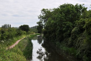
Looking to the South, the Bridgwater & Taunton Canal seen from Coxhill Narrow. |
Les regards portés vers le Sud, le Canal de Bridgwater & Taunton vu du Retrécissement de Coxhill. |
14-06-2015
Click to enlarge - Cliquer sur l'image pour agrandir |
27-11-2017
Click to enlarge - Cliquer sur l'image pour agrandir |
|
Looking to the North, the Bridgwater & Taunton Canal seen from Coxhill Narrow. |
Les regards portés vers le Nord, le Canal de Bridgwater & Taunton vu du Retrécissement de Coxhill. |
|
Visitez/Bezoek/Visit
Click on the image - cliquer sur l'image |
|
The Bridgwater & Taunton Canal |
|
|